Dunbar and Vicinity Location Detail

Return to Dashboard

Zip Codes Surveyed

Census Tracts Surveyed

Census Block Groups Surveyed

Dunbar is a neighborhood in the Cape Coral Area in Lee County, Florida. It is in Zip Codes 32801 and  32805; and Census Tracts: 010400, 010500, and 018900

All Zip Codes surveyed are served by the Lee County Unified School District

Zip Codes 33916,33901 and 33914 are in Congressional District FL-19 and State Senate District  FL-27

Zip Codes 33916 and  33901 are in State House District FL-78; and Zip Code 33914 is in State House Districts FL-76 and  FL-77.

Lehigh Acre’s Zip Code 33972 is served by Congressional Districts FL-17 and FL-19, State Senate District FL-28, and State House District FL-79.

Click on BOLD text for detail.

Dunbar

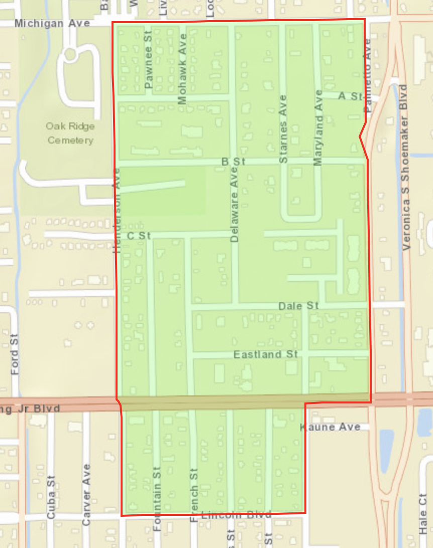
Census Block Group 120710005023

Population 245 

  • Michigan Ave to the North
  • Lincoln Blvd to the South
  • Palmetto Ave to the East
  • Henderson Ave to the West


Dunbar

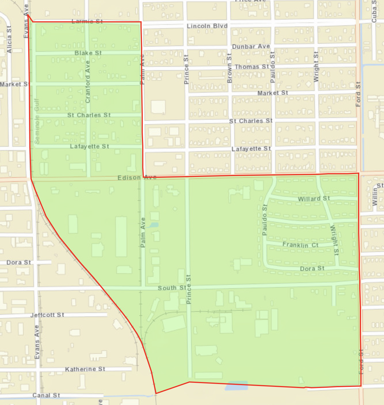
Census Block Group 120710006001

Population 629

  • Larmie St and Edison Ave to the North
  • Canal St to the South
  • Palm Ave and Ford St to the East
  • Evans Ave and the Railroad track to the West


Dunbar

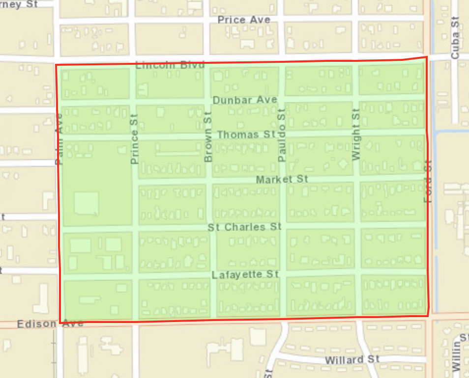
Census Block Group 120710006002

Population 665

  • Lincoln Blvd to the North
  • Edison Ave to the South
  • Ford St to the East
  • Palm Ave to the West


Dunbar

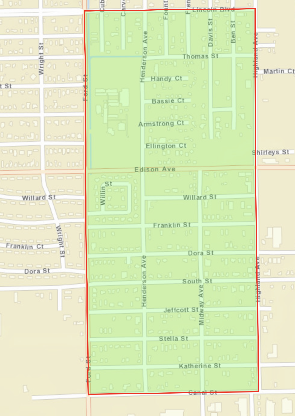
Census Block Group 120710006003

Population 1,573

  • Lincoln Blvd to the North
  • Canal St to the South
  • Highland Ave to the East
  • Ford St to the West


Dunbar, Ft. Myers

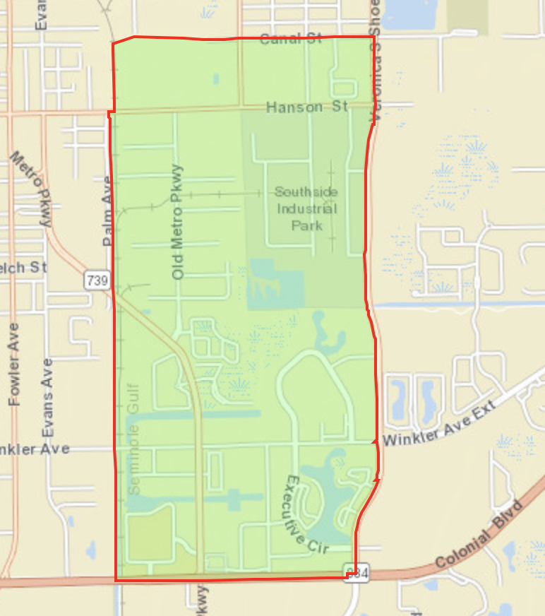
Census Block Group 120710012011

Population 3,816

  • Canal St to North
  • Colonial Blvd to the South
  • Veronica Shoemaker Blvd
  • Palm Ave to the West


Dunbar

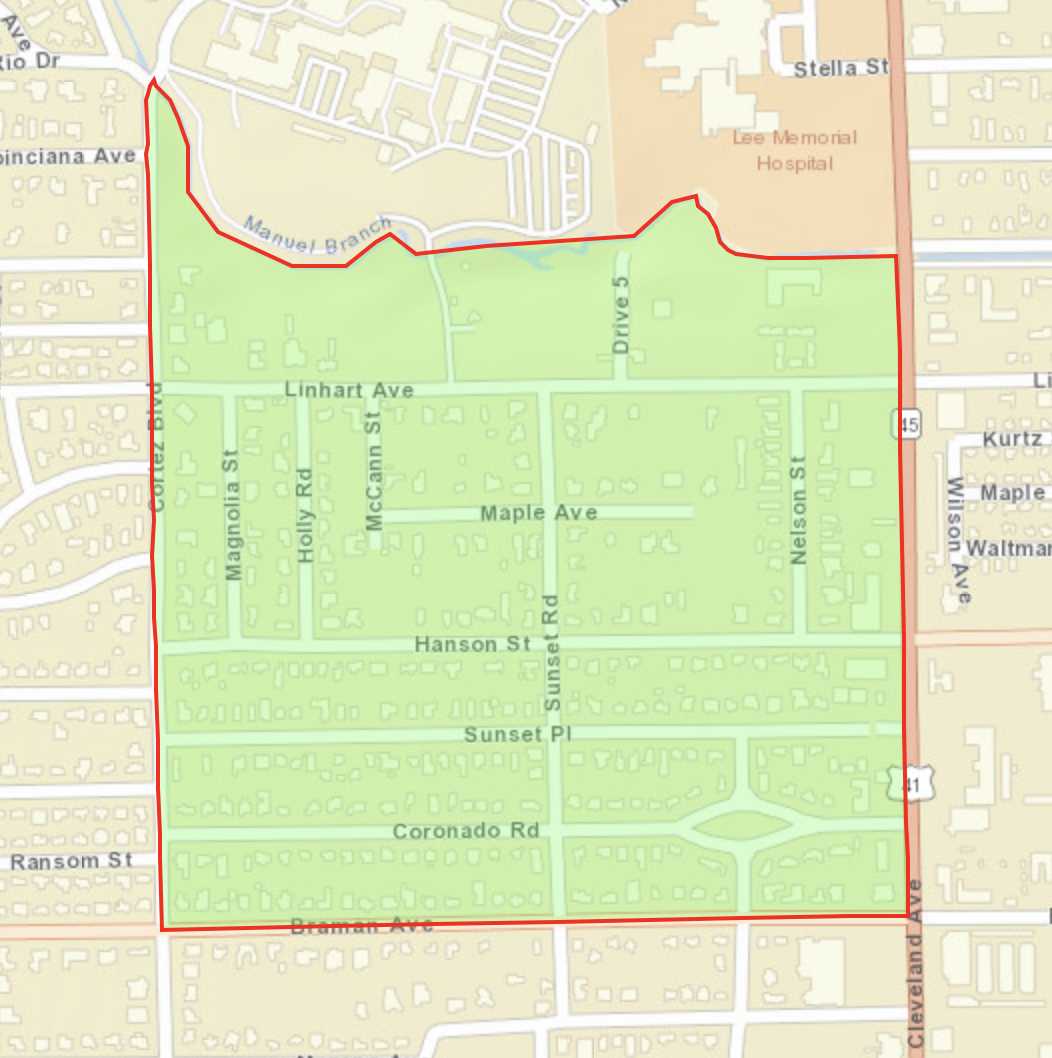
Census Block Group 1120710010002

Population 1,960

  • Manuel Branch to the North
  • Braman Ave to the South
  • Cleveland Ave (Rt 41) to the East
  • Cortez Blvd to the West


Cape Coral

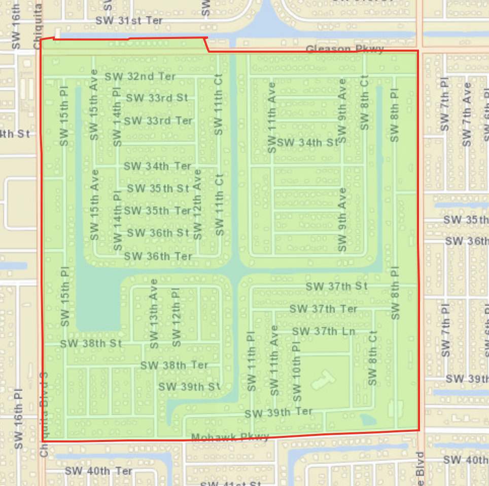
Census Block Group 120710104105

Population 1,364

  • Gleason Pkwy to the North
  • Mohawk Pkwy to the South
  • Skyline Blvd to the East
  • Chiquita Blvd S to the West


Lehigh Acres

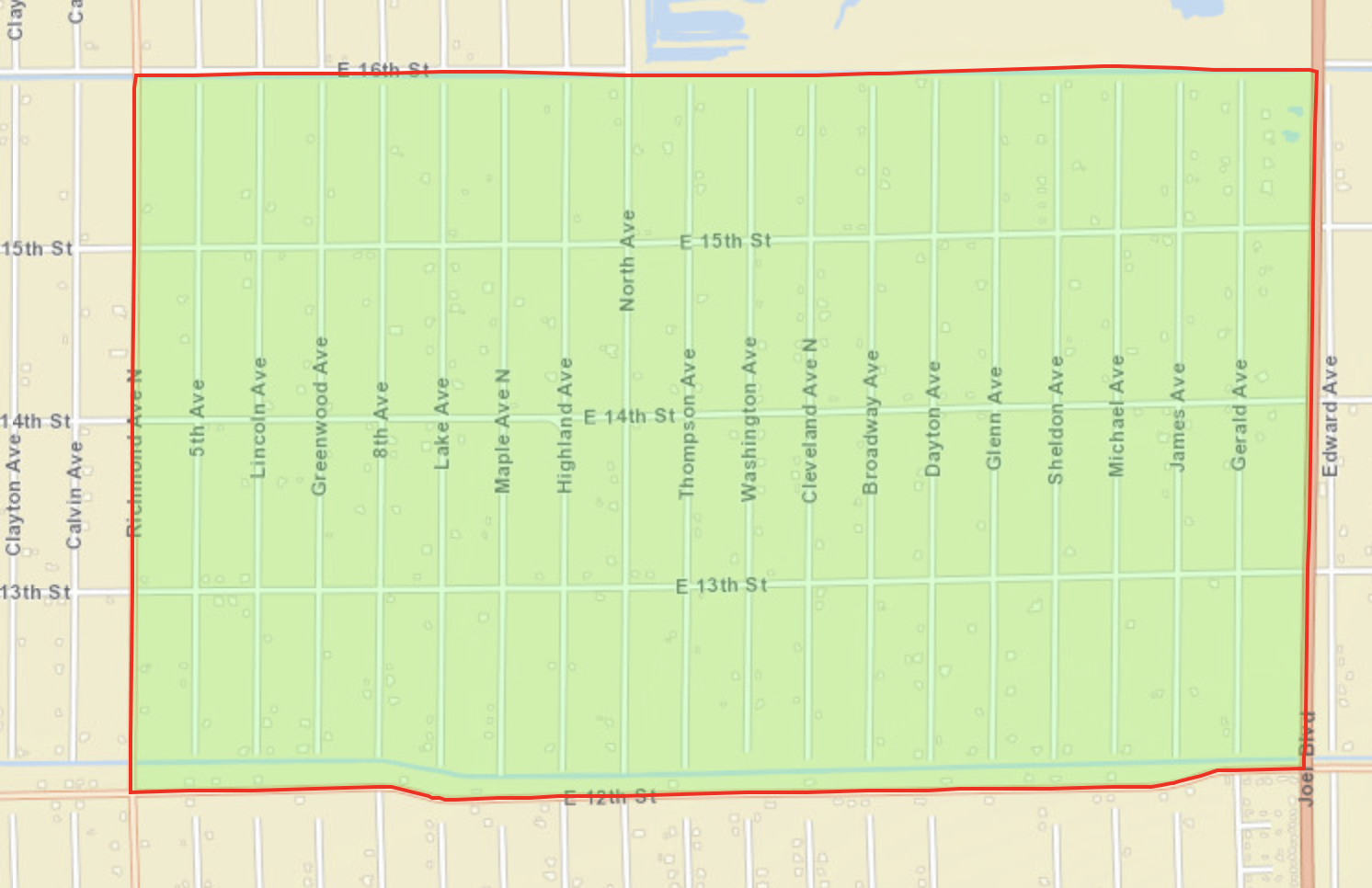
Census Block Group 120710402101

Population 785

  • E 16th St to the North
  • E 12th St to the South
  • Joel Blvd to the East
  • Richmond Ave N to the West


uufbr-green-sanctuary        

This website is maintained by Unitarian Universalist Justice Florida’s Climate Resilience Ministry. It was established by the Green Sanctuary Committee of the Unitarian Universalist Fellowship of Boca Raton under EPA Grant #EQ-00D35415-0. Videos and PowerPoints on this webpage were produced under the auspices of Health Initiatives Foundation, Inc.’s Florida Disaster Resilience Initiative with funding from The Miami Foundation. 

Website designed and maintained by Janice T. Booher, M.S.