Casselberry and Vicinity Location Detail


Return to Dashboard

Zip Codes Surveyed

Census Tracts Surveyed

Census Block Groups Surveyed

Casselberry is served by the Seminole County Unified School District, Congressional District FL-7, State Senate District FL-9, and State House Districts FL-28, FL-29 and FL-30It includes Zip Codes 32701, 32707, 32708, 32730, 32750, 32751, and 32792. It has a population of 26,649 residents in 10,429 households.  The Census Tracts from which surveys were collected include: 022101, 021404, 022104, and 02206. Surveys were collected from neighboring tracts as well.


Click on BOLD text for detail.

Casselberry Vicinity

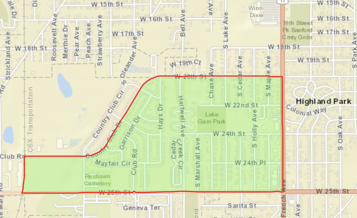
Census Block Group 121170203021

Population 2,141

  • Country Club Dr. and W 20th St to the North
  • W 25th St to the South
  • S French Ave to the East (Rt 17)
  • CSX Transportation Rail line to the West


Casselberry Vicinity

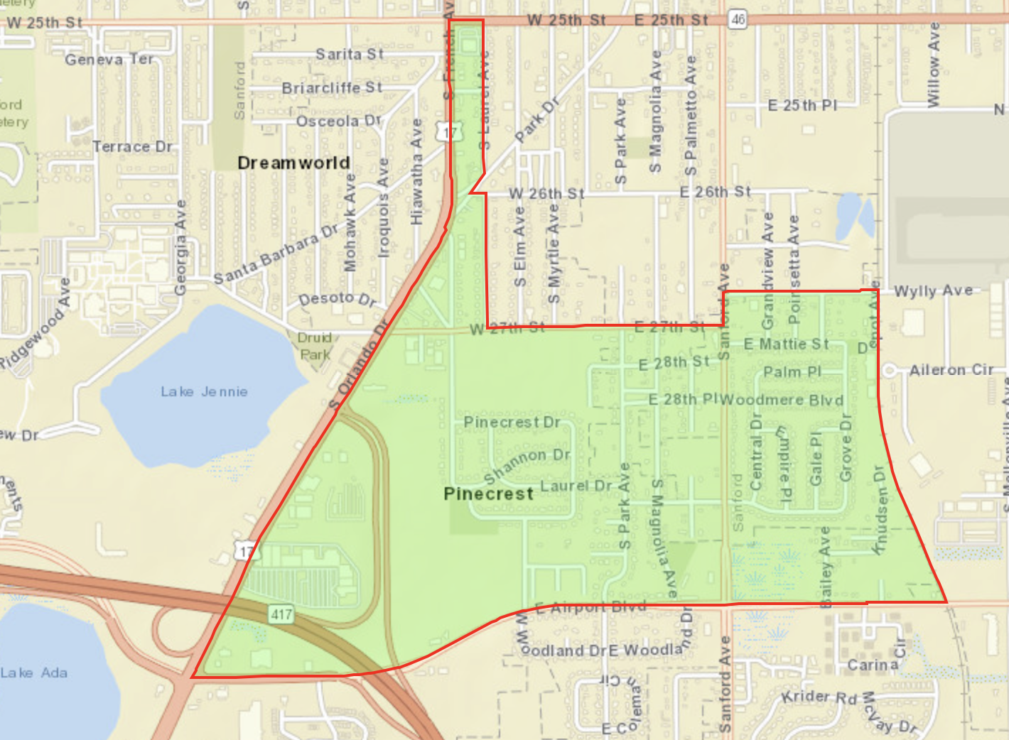
Census Block Group 121170209022

Population 1,107

  • W 25th St, 27th St, and Wylly Ave to the North
  • E Airport Blvd to the South
  • Depot Ave to the East
  • S Orlando Ave (Rt 17) to the West


Casselberry Vicinity

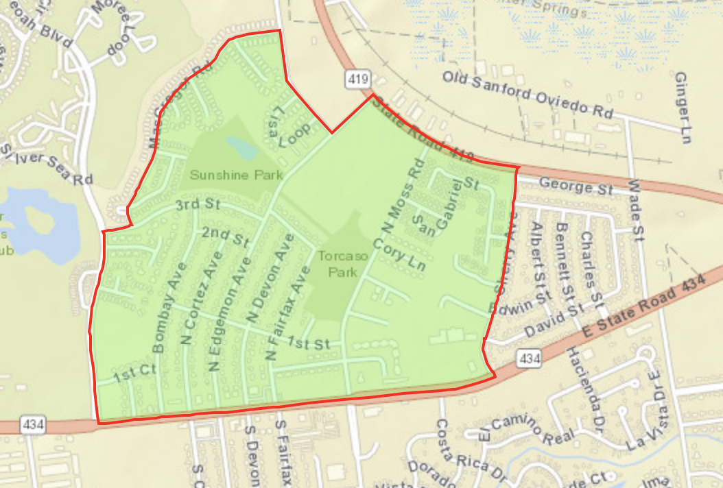
Census Block Group 121170214012

Population 1,625

  • State Rd 419 to the North
  • State Rd 434 to the South
  • Shelly Ave to the East
  • MacGregor Rd to the West


Casselberry Vicinity

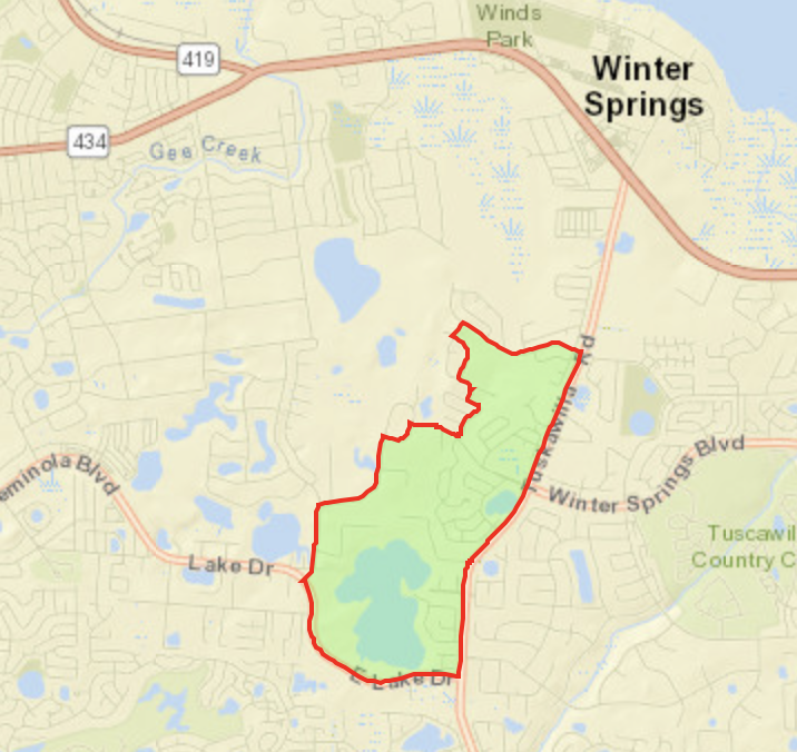
Census Block Group 121170214033

Population 2,077

  • Trotwood Blvd to the North
  • E Lake Dr to the South
  • Tuskawilla Rd to the East
  • Bird Rd and Dunmafr Cir, Dunmar Way, and Night Owl Ln to the West


Casselberry 

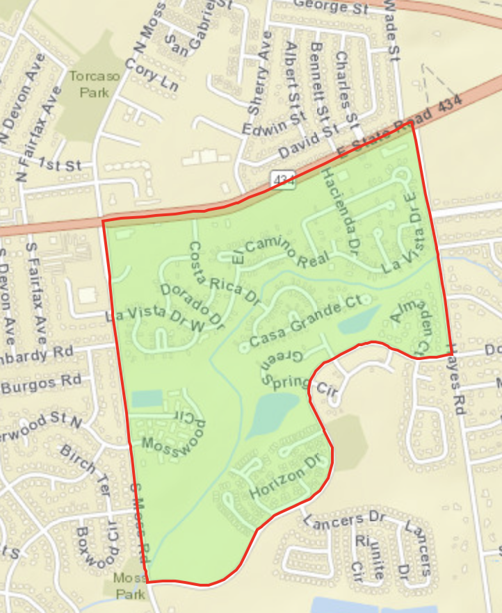
Census Block Group 121170214042

Population 1,235

  • E State Rd 434 to the North
  • Wintergreen to the South
  • Hayes Rd to the East
  • S Moss Rd to the West


Casselberry

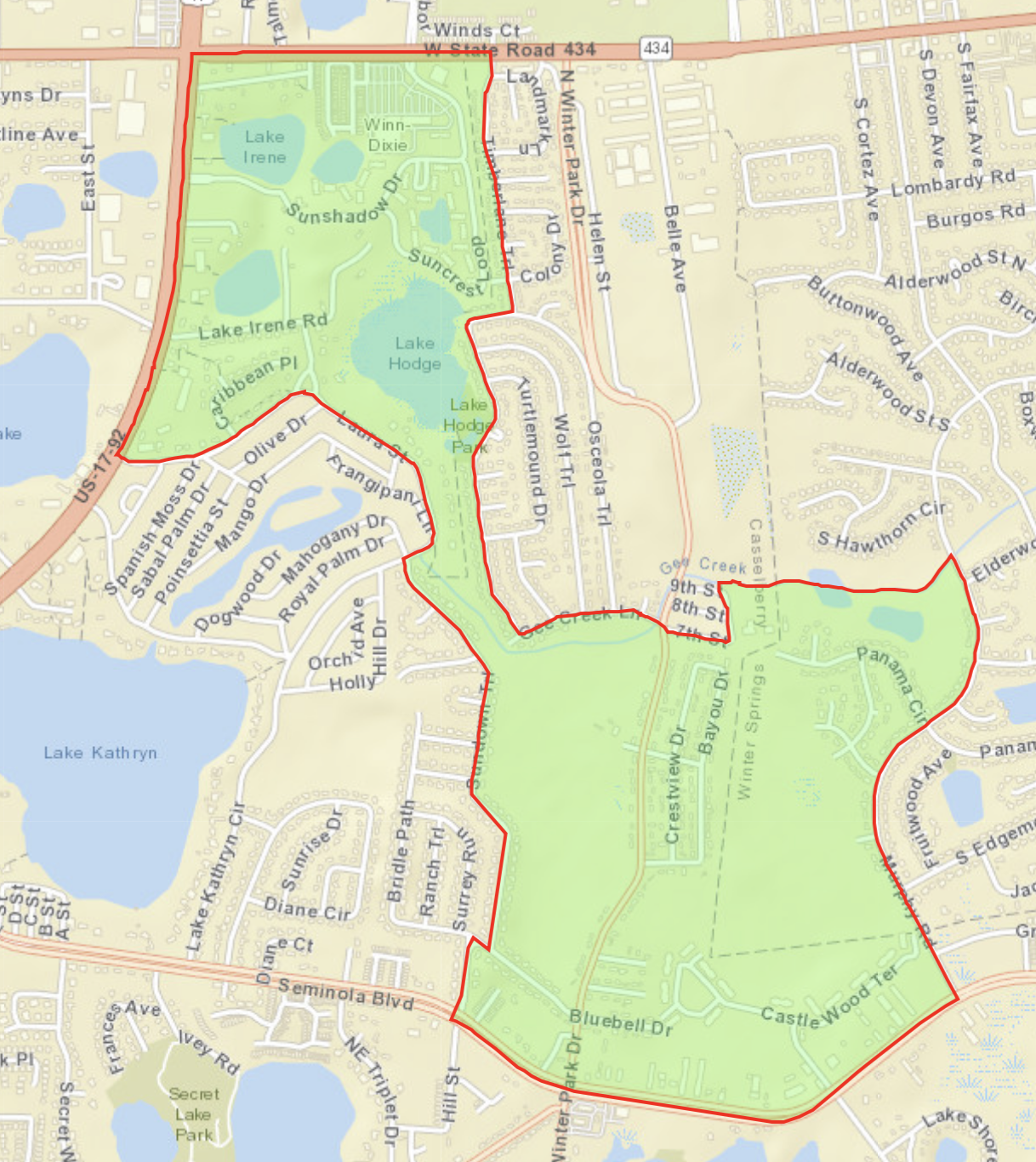
Census Block Group 121170221012

Population 2,811

  • W State Rd 434, Bee Creek Ln, and 7th St to the North
  • Laura St and Seminola Blvd to the South
  • Timberlane Trail and Murphy Rd to the East
  • US-17-19 and Sundown Trail to the West


Casselberry

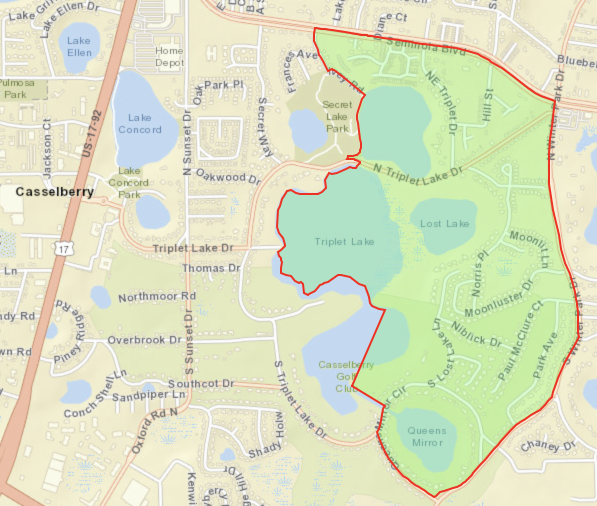
Census Block Group 121170221041

Population 1,227

  • Seminola Blvd to the North
  • South Winter Park Dr to the South
  • South Winter Park Dr to the East
  • Ivey Rd, Triplet Lake, and Casselberry Golf Club to the West


Casselberry Vicinity

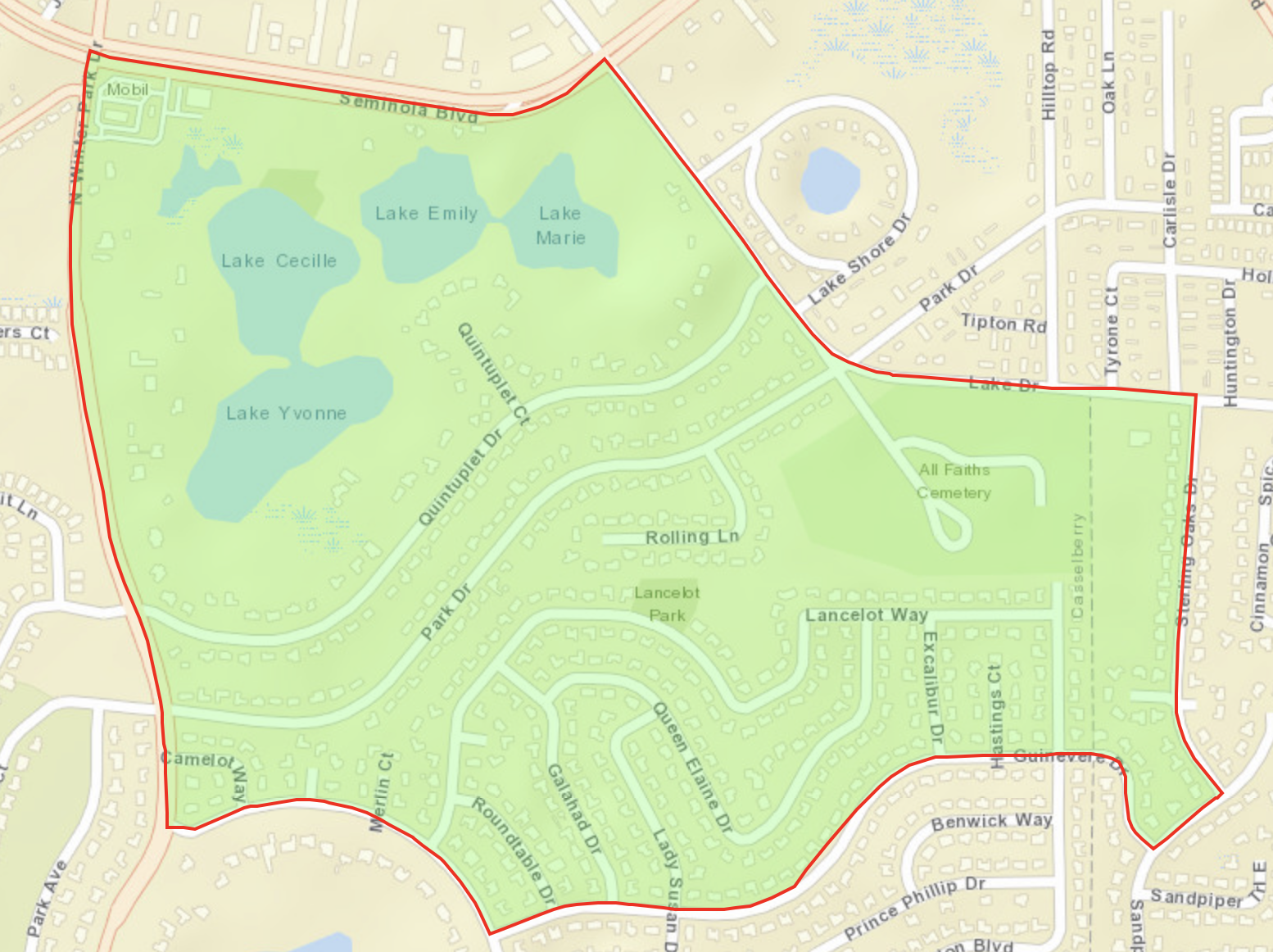
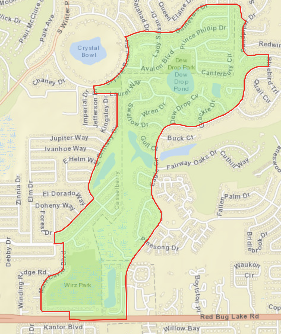
Census Block Group 121170221042

Population 1,179

  • Seminola Blvd to the North
  • Guinevere Dr to the South
  • Sterling Oaks Dr to the East
  • S Winter Park Dr to the West


Casselberry

Census Block Group 121170221044

Population 1,825

  • Guinevere Dr to the North
  • Red Bug Lake Dr to the South
  • Eagle Circle and Sandpiper Dr to the East
  • Benedict Way and Brittany Circle to the West


Casselberry and Vicinity

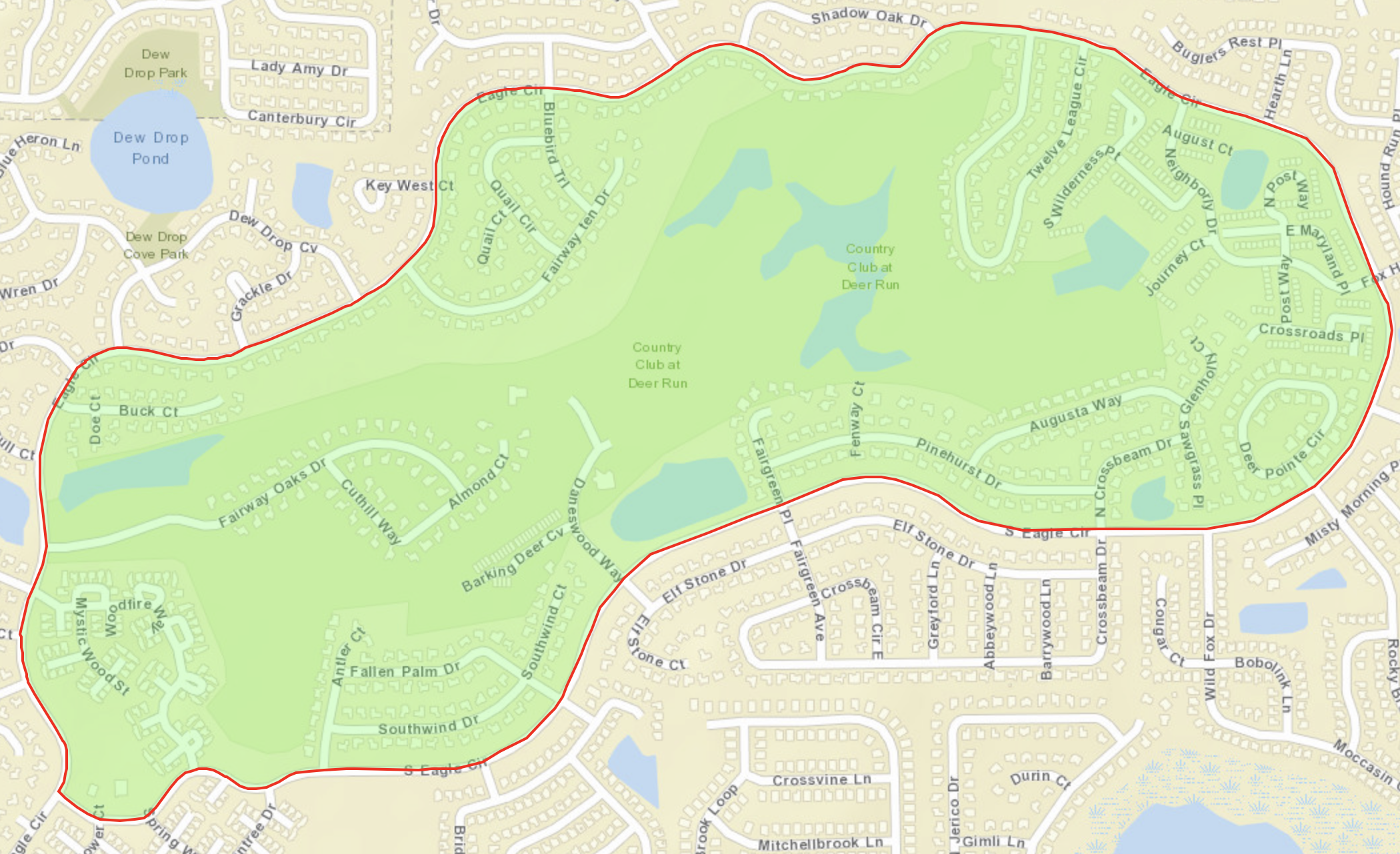
Census Block Group 121170221051

Population 2,007

  • Eagle Cir to the North
  • Eagle Cir to the South
  • Eagle Cir to the East
  • Eagle Cir to theWest


Casselberry Vicinity

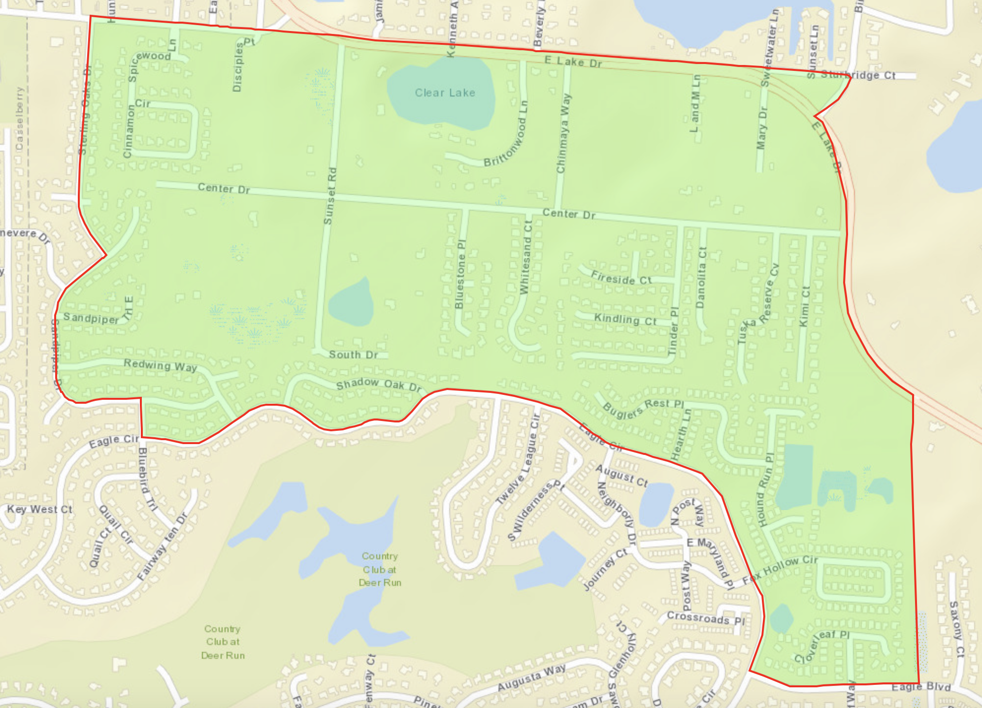
Census Block Group 121170221052

Population 1,708

  • E Lake Dr to the North
  • Eagle Cir to the South
  • E Lake Dr to the East
  • Sterling Oaks Dr and Sandpiper Dr to the West

Casselberry

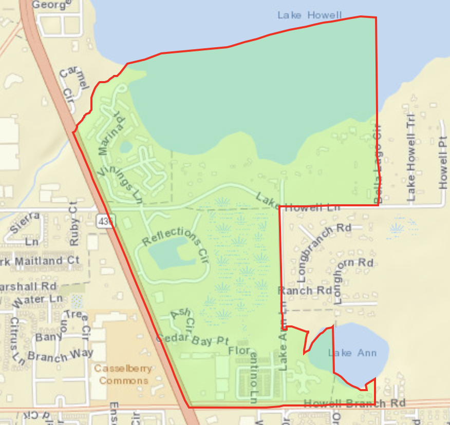
Census Block Group 121170222064

Population 1,905

  • Howell Creek to the North
  • Howell Branch Rd to the South
  • Lake Ann Ln and Bells Lage Cir to the East
  • Semoran Blvd (436) to the West

uufbr-green-sanctuary        

This website is maintained by Unitarian Universalist Justice Florida’s Climate Resilience Ministry. It was established by the Green Sanctuary Committee of the Unitarian Universalist Fellowship of Boca Raton under EPA Grant #EQ-00D35415-0. Videos and PowerPoints on this webpage were produced under the auspices of Health Initiatives Foundation, Inc.’s Florida Disaster Resilience Initiative with funding from The Miami Foundation. 

Website designed and maintained by Janice T. Booher, M.S.